Reynolds Mountain
Round-trip distance: 7 miles
Elevation gain: 2,800 feet
It was brisk and sunny morning at Logan Pass, which I agree with Bob Sihler is easily the most fantastic setting of any trailhead I have visited. Two days earlier I had been introduced to the grandeur of Glacier National Park. Along the lower ramparts of Going-to-the-Sun Road, the aspens were at their peak of color. At the trailhead the tundra was a colorful autumn mix of reds, greens and yellows. And above it all rose the hulks and horns of some impressive mountain peaks. From Logan Pass, it was evident that the snow from a week earlier was intent on sticking to the north-facing slopes of the surrounding mountains. I had originally intended to climb the highly-exposed north face of Reynolds Mountain, but the approach from Logan Pass was the same no matter which route I chose, so I decided to get a better look at the face as I approached. Along the easy approach I had great views of Oberlin Peak, Clements Mountain and Bearhat Mountain.
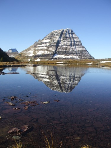
Bearhat Mountain
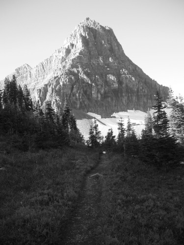
I crossed several easy snow slopes as I neared Reynolds Mountain's imposing north face, and with the amount of snow sticking to the face I was very hesitant to solo the route. By the time I arrived at the main saddle, I had made up my mind to go for the standard talus slopes route instead. I figured I could not go wrong just being out amidst such incredible scenery.
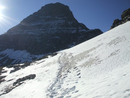
Approaching Reynolds Mountain
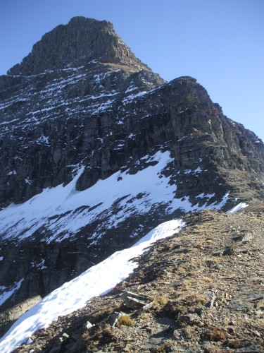
I came around the corner of the second saddle or col to the southwest of the mountain, then proceeded to spend the next two hours scouring the south face for the correct route up through the crumbling cliffs. The route was actually easy to find once the correct uphill turn was located; unfortunately I had missed the turn the first time and had gone much too far along the south face. I ended up walking ledge after ledge to a dead end, until I finally descended the southeast shoulder and back-tracked along the base of the lowest cliffs.
There I found the turn I had missed the first time, and the first of the cairns that would lead me most of the rest of the way. After kicking myself, I quickly gained altitude through the lower cliff band, then stopped for a bite to eat near an interesting rock formation on the southwest shoulder of the mountain. I know I often harp about scenery, but this truly was awesome. The weather was calm and nearly hot by this point. The sun highlighted the waves of snow-striped mountains and deep blue and green-colored alpine lakes deeply inset into the landscape below.
However I had to take my mind off paradise for a moment as I climbed a grueling--but expected--section of trail consisting of nothing but slippery scree. My calves burned as I took two steps forward, one slide back, over and over. When I arrived at the base of the cliffs, I had a little bit of difficulty when some misleading cairns led me to some more errant ledges. However I quickly realized my mistake and returned to the correct route, which I would follow through the upper cliffs the rest of the way to the summit.
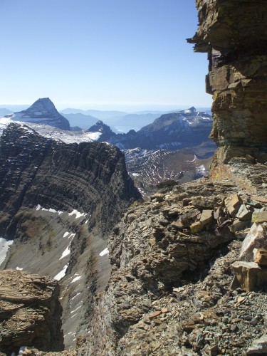
Exposed ledge during ascent
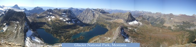
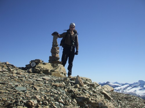
I arrived at the summit in early afternoon, the ascent taking me five long hours thanks to my route-finding difficulties. Finally I sat down to enjoy the best view I've found in the Lower 48 States. Photos on SummitPost were what initially intrigued me about Glacier National Park, but I can honestly say pictures do not do this place justice.
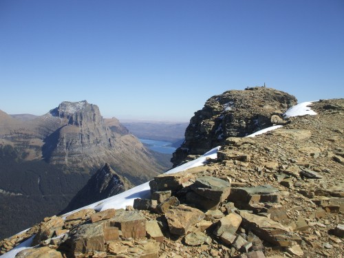
Approaching the summit
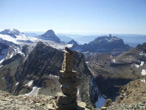
Summit cairn
The descent of the upper cliffs was the most tedious part of the day. To begin, there were plenty of handholds along the narrow, most exposed sections of ledge. The most difficult step was a steep down-climb with water running down over the smooth rock, followed by a plunge-step into a narrow shadowed pocket of snow. Below this it was just a couple more switchbacks down steep ledges to arrive atop the scree field.
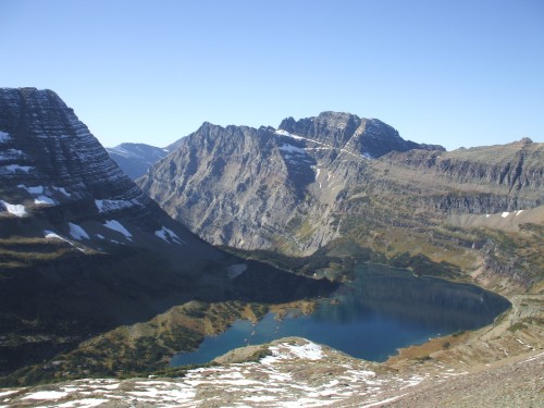
Mount Cannon and Hidden Lake
The scree was as pleasant to descend as it had been painful to climb. I basically skied the whole way down to the top of the lower cliffs, where I picked my way back down to the main trail. At this point Mount Cannon was reflected off Hidden Lake below, and I enjoyed that view the whole way back to the saddle.
Clements Mountain
I had been alone the whole day, but I passed more than a dozen people after rejoining the Hidden Lake Trail to Logan Pass. I talked to many of them along the way, and almost all were equally awed by the scenery as I was. None of them were interested in climbing the mountains--just looking at them. Here I share another sentiment with Bob, however: despite hoardes of visitors to areas such as this, the views from the summits are still reclusive treasures, even sacred to some of us. In any case–definitely worth the effort!