 Dad woke me up at six this morning–time to get ready for our hike. After much research
and discussion, we had finally decided Estes Cone would be the place. It looked to be a good
hike with a good view, and a good way for Dad to “get his feet wet” (though hopefully not
literally) in hiking the Rockies.
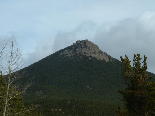
The mountain
To get to the trail head, we took the beautiful, scenic, and now familiar route up 36,
through Estes Park, and down CR 7 to the Longs Peak Trail Head. This is where our hike would
begin.
As we were getting our stuff out of the jeep and ready, Dad conversed with another man,
who was going to hike toward Longs Peak with his wife. They were not planning on going the
whole way to the summit, just practicing for a hike later this summer to the summit. They had
driven in in an SUV as well. In fact, all of the 11 vehicles there were either SUVs or trucks.
It was about 8:30 AM when we began our hike. We started up the snow-packed trail until
we came to where the trail split. From that point it was 7.0 miles to Longs Peak (left) 2.7 miles
to the summit of Estes Cone (right). To this point we had walked about half a mile.
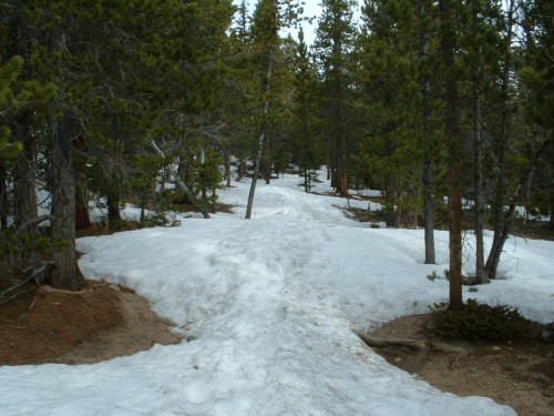
The trail
The walking from there was steady uphill, and almost all atop two to four feet of packed
snow. This was easy walking though, as the skies were cloudy and we did not stand much chance
of sinking in the white stuff. However, there were several deep footprints that indicated others
had had worse luck. By the end of the day, as the sun began coming out off and on, we did sink
from time to time, but it didn’t happen frequently enough to become an annoyance.
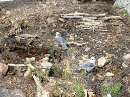
The Eugenia Mine, 0.9 mile from the aforementioned split in the trail, was our next
stopping point. We couldn’t find much if anything remaining of the actual mine, but there were
some remains of a log cabin and a number of huge piles of dirt that have been sitting there for
decades. We hiked uphill a good ways to explore a little and found two depressions in the ground
that Dad figured were the old mining sites. Then we returned to the creek bottom. We stopped
and ate a few snacks and I also photographed two inquisitive birds while we were there.
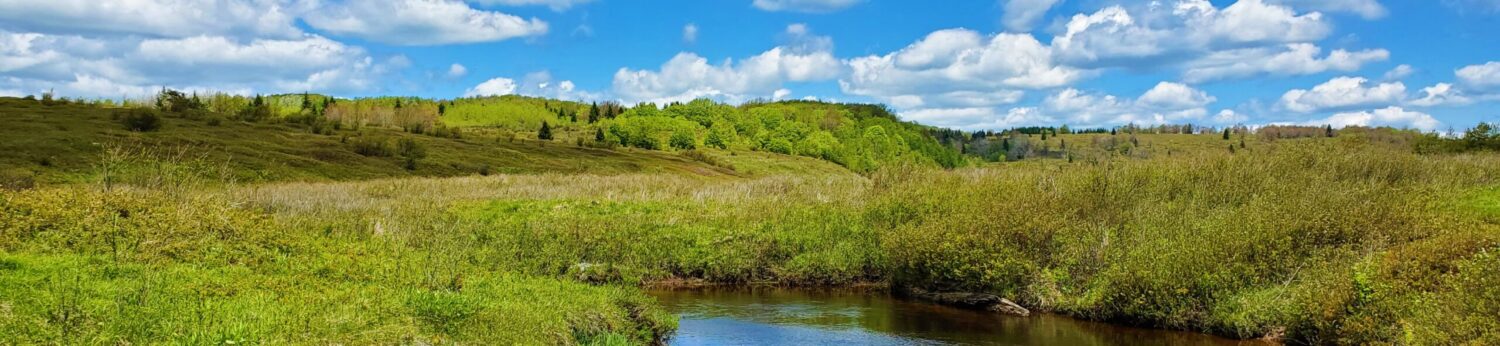
A little while later, the trail led into a wide-open meadow. We found some deer and/or elk
sign around here, which was interesting. There were snow flurries at this point in our journey,
and it would pick up to actual snow squalls eventually, but it never got heavy enough to lay more
than a couple of millimeters on the ground around us.
The next turn in the trail was a sort of “V,” that told us we had 1.2 miles left to the
summit–mostly steep uphill. Half a mile up the side of the slope we found ourselves at Storm
Pass, where a couple other trails split off to go different places. This is where the cairns began,
and they are what led us the rest of the way to the summit.
The going was very steep in this section– the final 7/10ths of a mile. I had felt my lungs
constricting as we started up from the “V,” but hit my “second wind” before reaching the real
steep part. Dad, who was not used to the elevation at all, had to stop more and more frequently
as we continued uphill, and he was breathing very heavily. We found for both of us though, that
short breaks were quite effective at refreshing us, even at that elevation.
The scenery was almost surreal. It seemed half the trees around us (all evergreens) had
been struck by lightning, and those that weren’t were just as ugly. Those gnarly, twisted old
things were growing up out of mostly rock, and a little pebbly soil. The snow drifts remained just
as crazy too: three feet here, bare ground there, and so on.
We came to the top long before either of us expected we would. Just like that we came to
a very rocky area with few trees, and realized there was nothing more above this but sky–well,
and some falling snow.
This wasn’t technically “the summit” yet though. We climbed up a wall of rocks and then
back down a kind of ravine and up the other side of a yet bigger area of boulders, where we found
a pile of rocks someone had constructed on the very top–the summit of Estes Cone. I must say,
this “cone” didn’t appear very “conical” from atop it. It was more. . . oblong, and jagged.
A chipmunk greeted us, and we watched it run around for most of the hour or so we were
up there. There were at least two, we think. Also, during our initial approach to the summit, we
apparently scared a whole “flock” of sparrows or something out of the rocky cliffs at the top of
the mountain. That was an interesting sight.
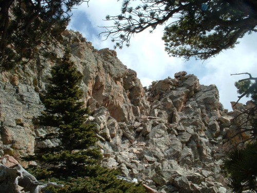
Cliffs guarding the summit
Anyway, we were now at the top. We marveled at the awesome scenery and took picture
after picture. From there we could clearly see Estes Park, the Great Plains and all the foothills to
the east, as well as the Twin Sisters Peaks. Not so clear were the larger mountains to the west,
those in Rocky Mountain National Park and in-particular Longs Peak, the only 14-er in the bunch.
However, even as we stood there, the skies opened up somewhat, and the weather changed from
snow right over us to blue sky in certain areas. Indeed, only at times was the wind very evident,
and even then rarely harsh. Seems we had not picked such a bad day after all to do this hike.
We remained for about an hour at the summit, taking pictures, signing in on an unofficial
“register” inside an old peanut butter jar, and just enjoying the scenery. The one problem was the
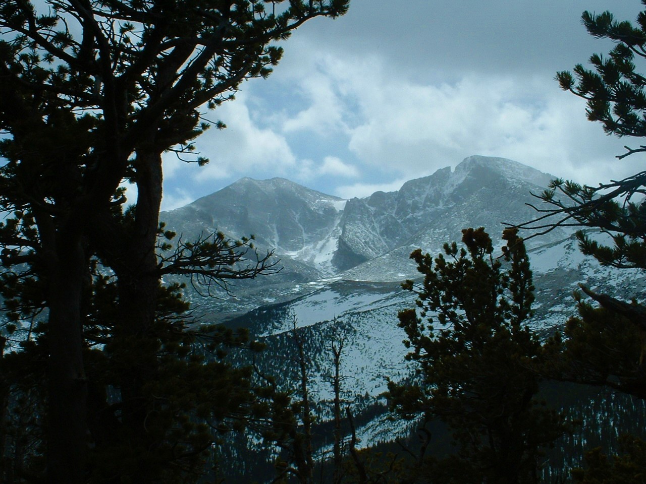
clouds full of snow did not want to let us see Longs Peak. Eventually they started to clear from
that area just a little, and we started snapping pictures furiously of the peak that rose more than
three thousand feet above the summit on which we now stood. By the way, we were at 11,006
feet above sea level.
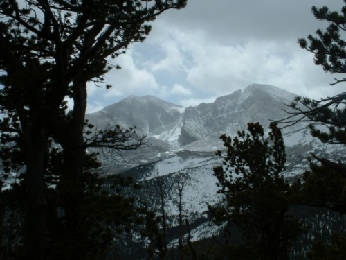
Mount Meeker and Longs Peak
Even as we started back down off “the cone,” the impressive view of Longs Peak
continued to become clearer, and we got even better pictures of it. At last we continued down
into the woods and headed out of the mountain the same way we had entered. It seemed much
shorter on the way out. We finished the 6.6 mile hike in seven hours, which included many stops
and a full hour spent at the summit. On our way out we passed some other hikers, and at the
parking lot we talked to one guy who had hiked to Longs Peak yesterday and stayed overnight at
the 11,000 foot level, with nothing but what he was wearing! He said the temperature was in the
teens last night, but he is used to that kind of stuff. Well, to each his own.
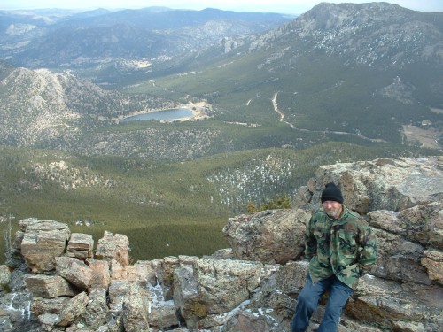
Dad on the summit of Estes Cone